
Lusaka, Zambia
Active · 2019Systematic Land Titling
A systematic land titling process developed with Zambia’s Ministry of Lands and Natural Resources and tested across more than 50,000 parcels in Lusaka.
- Titles the process was built to carry
- 5M
- Parcels documented in the Lusaka pilot
- 50,000+
Why fifty thousand parcels
Under Zambia’s 7th National Development Plan, the government set out to issue 5 million land titles on State Land through systematic land titling. The instrument existed; the throughput did not.
Medici Land Governance partnered with the Ministry of Lands and Natural Resources to establish, test, and implement a process that could carry that volume — and to deliver 50,000 titles in Lusaka as the proof.
The programme ran public meetings, adjudication, verification, corrections, and title issuance. Through a mobile application built on pre-vectorized property imagery, house-to-house collection, community verification, and machine learning validation, MLG processed documentation for more than 50,000 parcels.
Following the pilot, Lusaka City Council selected MLG to lead its property titling programme and develop the supporting land governance platform.

The survey team in Lusaka, with the aircraft that flies the imagery the titling programme is built on.
The process
How a city gets titled
Systematic land titling in Lusaka, from the first aerial survey to final government approval. The six stages connect survey, GIS, field enumeration, community verification, and council review.

Stage 1: Imagery Acquisition
Areas of interest are selected and surveyed by drone, aircraft, or satellite to capture high-resolution imagery for the land survey.
The imagery is post-processed into georeferenced high-resolution tiles for GIS software, so the information a title certificate requires can be extracted under the land survey and planning regulations.

Stage 2: Pre-vectorization
Engineers and technicians delineate property boundaries from the high-resolution imagery in a Geographic Information System, working to planning standards.
Property attributes are assigned and checked through quality-assurance procedures. This is the step that makes the field work possible: enumerators arrive with boundaries already drawn, rather than drawing them at the door.
Stage 3: Enumeration
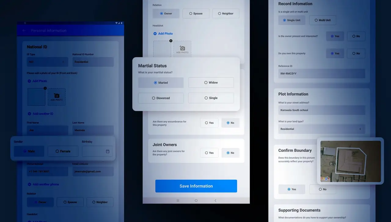
Enumerators collect spatial and ownership data from property owners across a demarcation area — house to house, with the pre-vectorized imagery in hand. The ENUM application records the GPS position required by the field workflow.

Stage 4: Data Review
Field data returns with boundary corrections confirmed by owners on the ground.
The GIS team applies the spatial adjustments, associates the ownership data with each parcel, and checks the result against surveying and planning standards.

Stage 5: Community Verification
The field team returns to central locations and demarcation areas to present the reviewed information to property owners for confirmation. Owners sign a second time.
Layout, land use, and verification maps are displayed publicly, so a community can see where the boundaries fall and how the land around them has been recorded.

Stage 6: Government Approval
The council uploads and approves the layout and land-use plans. The surveyor’s report and general plan then move through the required review and signature steps.
The examiner checks the signed general plan against the supporting records before government approval. Once approved, the parcels covered by the plan can proceed to title issuance.
Outcome
What the six stages produce
A certificate of title, in the hands of the person who lives on the land. Everything above exists to get from an unrecorded roof on an aerial photograph to this.